Weekend Weather Forecast
Met Service
23 February 2023, 9:38 PM

Warkworth Region
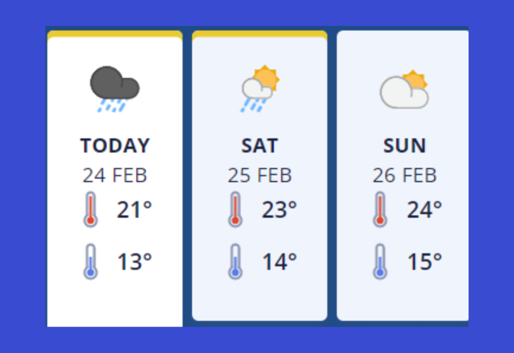
Friday 24th February - Periods of rain, heavy at times. Thunderstorms and localised downpours possible from afternoon. Southeasterlies, dying out this evening.
Heavy Rain Watch
Period: 21hrs from 9am Fri, 24 Feb - 6am Sat, 25 Feb
Area: Auckland including Great Barrier Island
Forecast: Periods of heavy rain, with thunderstorms and downpours possible, especially from afternoon. Rainfall amounts may reach warning criteria. Note, a Severe Thunderstorm Watch is also in force for this area.
Severe Thunderstorm Watch
Period: 13hrs from 9am - 10pm Fri, 24 Feb
Area: Northland, Auckland, Great Barrier Island
Forecast: Scattered thunderstorms are expected about parts of the northern North Island today, with localised heavy rain and possible downpours. For southern Northland, Auckland north of Orewa and near the west coast about and west of the Waitakere ranges, and Great Barrier Island, a few of the thunderstorms could be severe with localised downpours of 25-50mm/h. The main risk is between about midday and 10pm today (Friday), but the risk could start on Great Barrier Island this morning (from 9am). Rainfall of this intensity can cause surface and/or flash flooding, especially about low-lying areas such as streams, rivers or narrow valleys, and may also lead to slips. Driving conditions will also be hazardous with surface flooding and poor visibility in heavy rain. The thunderstorms activity should ease late evening.
Severe Thunderstorm Watch
Period: 7hrs from 5pm Fri, 24 Feb - midnight Fri, 24 Feb
Area: Auckland, Coromandel Peninsula, Bay of Plenty
Forecast: Scattered thunderstorms are expected about parts of the northern North Island today, with localised heavy rain and possible downpours. For parts of Auckland south of Orewa and east of the Waitakere ranges, Coromandel Peninsula and western Bay of Plenty from about Tauranga northwards, a few of the thunderstorms could be severe with localised downpours of 25-40mm/h. The main risk of severe thunderstorms in this area is between about 5pm and midnight tonight (Friday). Rainfall of this intensity can cause surface and/or flash flooding, especially about low-lying areas such as streams, rivers or narrow valleys, and may also lead to slips. Driving conditions will also be hazardous with surface flooding and poor visibility in heavy rain. The thunderstorms activity should ease overnight.
Saturday 25th February - Rain clearing in the morning to partly cloudy skies. Isolated showers in the afternoon. Light winds and afternoon sea breezes.
Heavy Rain Watch
Period: 21hrs from 9am Fri, 24 Feb - 6am Sat, 25 Feb
Area: Auckland including Great Barrier Island
Forecast: Periods of heavy rain, with thunderstorms and downpours possible, especially from afternoon. Rainfall amounts may reach warning criteria. Note, a Severe Thunderstorm Watch is also in force for this area.
Sunday 26th February - Mainly fine, isolated showers in the afternoon and evening. Light winds and afternoon sea breezes.

Mangawhai Region
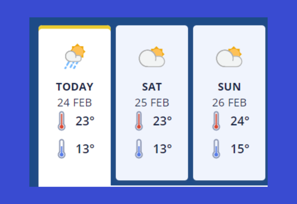
Friday 24th February - Partly cloudy. A few showers, some heavy, with a risk of thunderstorms and downpours from afternoon. Westerly breezes.
Severe Thunderstorm Watch
Period: 13hrs from 9am - 10pm Fri, 24 Feb
Area: Northland, Auckland, Great Barrier Island
Forecast: Scattered thunderstorms are expected about parts of the northern North Island today, with localised heavy rain and possible downpours. For southern Northland, Auckland north of Orewa and near the west coast about and west of the Waitakere ranges, and Great Barrier Island, a few of the thunderstorms could be severe with localised downpours of 25-50mm/h. The main risk is between about midday and 10pm today (Friday), but the risk could start on Great Barrier Island this morning (from 9am). Rainfall of this intensity can cause surface and/or flash flooding, especially about low-lying areas such as streams, rivers or narrow valleys, and may also lead to slips. Driving conditions will also be hazardous with surface flooding and poor visibility in heavy rain. The thunderstorms activity should ease late evening.
Saturday 25th February - Fine breaks. Light winds.
Sunday 26th February - Mainly fine. Light winds.


