Warning Cyclone Fili could bring coastal floods to NZ, severe gales, heavy rain

Met Service
10 April 2022, 7:28 PM
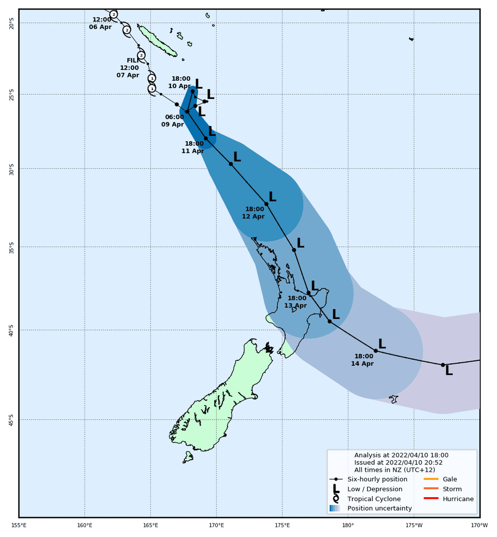
MetService has warned tropical cyclone Fili may cause coastal floods, severe gales reaching 100km/h and bring heavy rain as it expects to reach New Zealand in the next 24 hours.
It is expected Cyclone Fili will approach the North Island from New Caledonia on Tuesday before tracking south across the island on Wednesday before blowing out on Thursday.
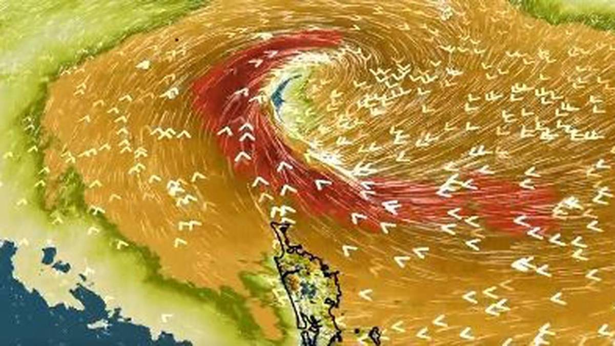
Niwa said the entire North Island was at risk of severe gales, with warnings that gusts could reach 100km/h in some regions on Wednesday.
WeatherWatch said heavy rain was "once again forecast to hit the eastern side of the North Island, including similar areas recently hit by severe flooding".
"The storm will move in on Tuesday or Wednesday with gales from the easterly quarter, which turn more southerly with a potentially damaging sting in the tail on Wednesday/Thursday as southerly quarter winds kick in from Cook Strait to Auckland and ramp up more as the storm now deepens," WeatherWatch said in an update at 10.15am on Sunday.
"There are likely to be slips, isolated flooding and road disruptions this coming week in the North Island. Power outages are also possible with winds strong enough to bring down trees and branches.


