Severe Weather Outlook

Met Service
10 April 2022, 3:04 AM

This weeks weather isn't looking good. Just a heads up... It's a good idea to be prepared for the possibility of road closures or power outages. We'll keep you up to date
Model differences- Here is an image showing the 24 hour rainfall accumulation, MSLP and wind barbs at midnight Wednesday night, from three different global models (NCEP on the left, UKMO in the middle, and ECMWF on the right). Rainfall legend is just below the image.
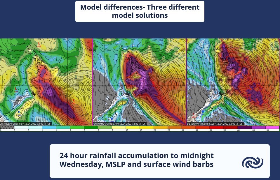
As you can see, there's a large difference in where the models think Cyclone Fili will be at this time, which also impacts where the largest rainfall accumulation and strongest winds will be. Because of these model differences, we have highlighted areas that could be in the firing line for severe weather on our Severe Weather Outlook which you can find here https://www.metservice.com/warnings/severe-weather-outlook.
We have already issued a Heavy Rain Watch and a Strong Wind Watch for Northland, starting Tuesday afternoon. More regions in the North Island are likely to be impacted during Wednesday into Thursday. As details become clearer and models come more into agreement, our Watches and Warnings will be updated. You can check the latest warnings here http://bit.ly/AllWarnings.
This could be a significant event, and it is advised to stay up to date with the forecasts and warnings over the coming days.

