Cyclone Dovi on route to Aotearoa

The Matakana App
11 February 2022, 2:09 AM

A severe tropical cyclone will dive-bomb into New Zealand this weekend bringing heavy rain and damaging gales for both islands.
Cyclone Dovi became a severe category 3 cyclone on Friday as it tracked past New Caledonia towards Aotearoa, WeatherWatch said.
It's expected to still be severe when it arrives in the country over the weekend.
"The storm is expected to retain category 2 strength as it dive-bombs into the NZ area this weekend from the north.
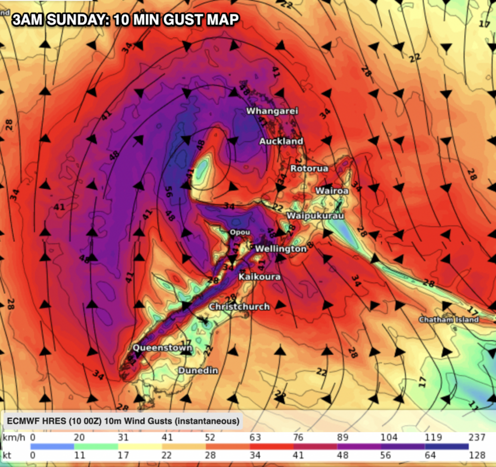
"While it will have a lot of intense energy as it moves southwards over the Tasman Sea it is expected to unravel over NZ - but that means it will dump a lot of rain here and as it 'falls apart' it will also bring areas of damaging gales into both main islands," WeatherWatch said.
Central New Zealand is in for a battering with 100 to 300mm of rain possible. WeatherWatch warns the rain could cause slips, flooding and road closures.
The storm will "fall apart" as it moves, becoming an ex-tropical cyclone and bringing damaging winds to both islands over the weekend.
Gusts may be anywhere from 100km/h to 150km/h, WeatherWatch says.
Dovi is expected to make landfall in Aotearoa late Sunday night or early Monday morning somewhere in the western North Island most likely between the Waikato and Taranaki.